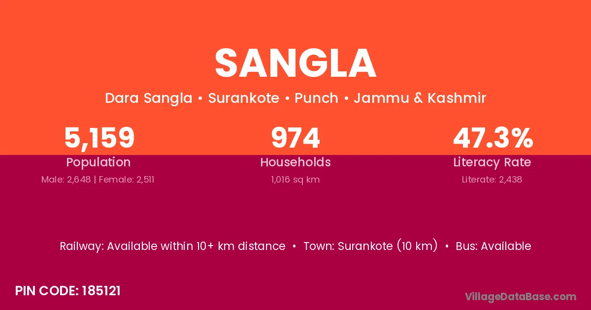
Sangla village is located in the Surankote Tehsil of the Punch district in Jammu & Kashmir .
Block / Tehsil → Surankote
District → Punch
State → Jammu & Kashmir
According to Census 2011 information, the village code of Sangla village is 185121.
Sangla village has a total population of 5,159 people, of which 2,648 are males and 2,511 are females.
The literacy rate of Sangla village is 47.26%. Male literacy stands at 58.01% and female literacy at 35.92%.
There are approximately 974 households in Sangla village.
Surankote (10 km) is the nearest town to Sangla village for major economic activities and is located approximately 10 km away.
The population of Sangla village is distributed between literate and illiterate residents as follows:
| Particulars | Male | Female | Total |
|---|---|---|---|
| Literate | 1,536 | 902 | 2,438 |
| Illiterate | 1,112 | 1,609 | 2,721 |
| Total | 2,648 | 2,511 | 5,159 |
Source: Census 2011
| Village | District |
|---|---|
| Dandi Dhara | Punch |
| Daraba | Srikakulam |
| Daraba | Punch |
| Daraba | Gajapati |
| Daraba | Jagatsinghapur |
| Dhara Mohara | Punch |
| Fazal Abad | Punch |
| Gaunthal | Punch |
| Kalar Kattal | Punch |
| Pamrote | Punch |
| Potha | Papum Pare |
| Potha | Punch |
| Potha | Rajouri |
| Potha | Rajouri |
| Potha | Aligarh |
| Samote | Punch |
| Sangliani | Punch |
| Surankot | Punch |
No reviews yet. Be the first to review this village!
Available within 10+ km distance
Available within 5 - 10 km distance
Available within 5 - 10 km distance