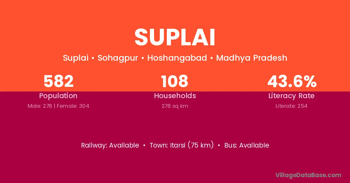
Suplai village is located in the Sohagpur Tehsil of the Hoshangabad district in Madhya Pradesh .
Block / Tehsil → Sohagpur
District → Hoshangabad
State → Madhya Pradesh
Suplai village has a total population of 582 people, of which 278 are males and 304 are females.
The literacy rate of Suplai village is 43.64%. Male literacy stands at 52.52% and female literacy at 35.53%.
There are approximately 108 households in Suplai village.
Itarsi (75 km) is the nearest town to Suplai village for major economic activities and is located approximately 75 km away.
The population of Suplai village is distributed between literate and illiterate residents as follows:
| Particulars | Male | Female | Total |
|---|---|---|---|
| Literate | 146 | 108 | 254 |
| Illiterate | 132 | 196 | 328 |
| Total | 278 | 304 | 582 |
Source: Census 2011
| Village | District |
|---|---|
| Barbhud | Hoshangabad |
| Churna | Hoshangabad |
| Jhalai | Hoshangabad |
| Jhalai | Panna |
| Jhalai | Dungarpur |
| Khakrapura | Hoshangabad |
| Khamda | Hoshangabad |
| Khamda | Amravati |
| Mallupura | Chamarajanagar |
| Mallupura | Mysore |
| Mallupura | Hoshangabad |
| Mallupura | Ujjain |
| Malni | Godda |
| Malni | Gulbarga |
| Malni | Betul |
| Malni | Chhindwara |
| Malni | Hoshangabad |
| Malni | Gondiya |
| Malni | Nagpur |
| Malni | Pali |
| Malni | Adilabad |
| Malni | Moradabad |
| Mana | Raipur |
| Mana | Mandi |
| Mana | Jammu |
| Mana | Balaghat |
| Mana | Guna |
| Mana | Guna |
| Mana | Hoshangabad |
| Mana | Raisen |
| Mana | Rajgarh |
| Mana | Shajapur |
| Mana | Akola |
| Mana | Chamoli |
| Ratibandar | Hoshangabad |
| Sakot | Hoshangabad |
| Sankai | Pashchimi Singhbhum |
| Sankai | Hoshangabad |
| Sankai | Koraput |
No reviews yet. Be the first to review this village!
Available
Available within 10+ km distance
Available within 10+ km distance