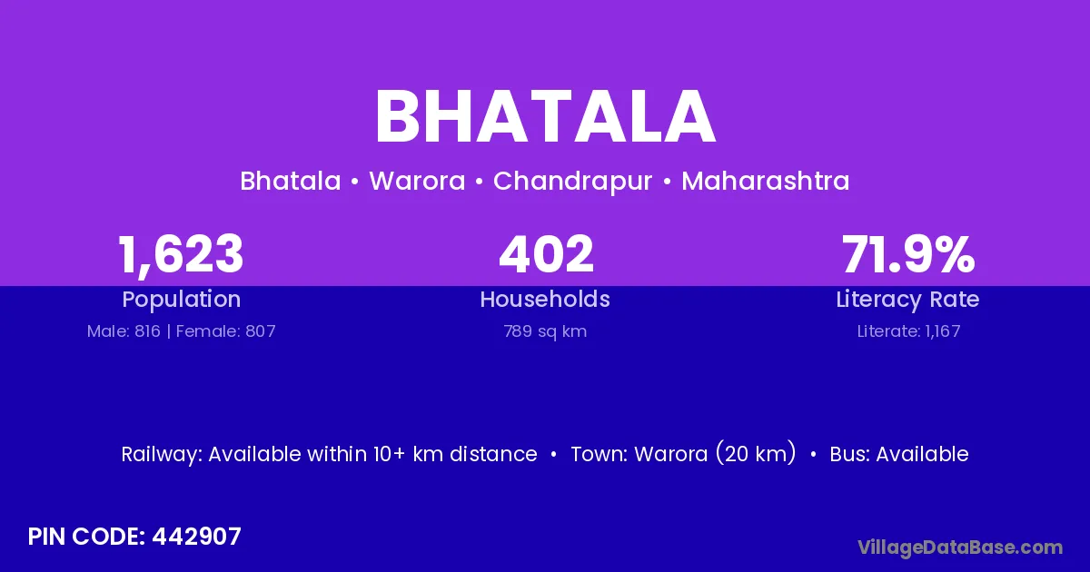
Bhatala village is located in the Warora Tehsil of the Chandrapur district in Maharashtra .
Block / Tehsil → Warora
District → Chandrapur
State → Maharashtra
According to Census 2011 information, the village code of Bhatala village is 442907.
Bhatala village has a total population of 1,623 people, of which 816 are males and 807 are females.
The literacy rate of Bhatala village is 71.90%. Male literacy stands at 80.88% and female literacy at 62.83%.
There are approximately 402 households in Bhatala village.
Warora (20 km) is the nearest town to Bhatala village for major economic activities and is located approximately 20 km away.
The population of Bhatala village is distributed between literate and illiterate residents as follows:
| Particulars | Male | Female | Total |
|---|---|---|---|
| Literate | 660 | 507 | 1,167 |
| Illiterate | 156 | 300 | 456 |
| Total | 816 | 807 | 1,623 |
Source: Census 2011
| Village | District |
|---|---|
| Asala | Chandrapur |
| Asala | Wardha |
| Atmurdi | Chandrapur |
| Atmurdi | Yavatmal |
| Bandara | Chandrapur |
| Borgaon De | Chandrapur |
| Khatoda | Mahesana |
| Khatoda | Chandrapur |
| Khatoda | Chandrapur |
| Mowada | Chandrapur |
| Mowada | Yavatmal |
| Nagpur Tukum | Chandrapur |
| Pimpalgaon Maroti | Chandrapur |
| Salori | Chamba |
| Salori | Chamba |
| Salori | Chandrapur |
| Salori | Chandrapur |
| Salori | Jodhpur |
| Salori | Mirzapur |
| Tembhurda | Chandrapur |
| Wanali Wangram | Chandrapur |
No reviews yet. Be the first to review this village!
Available within 10+ km distance
Available within village
Available within 10+ km distance