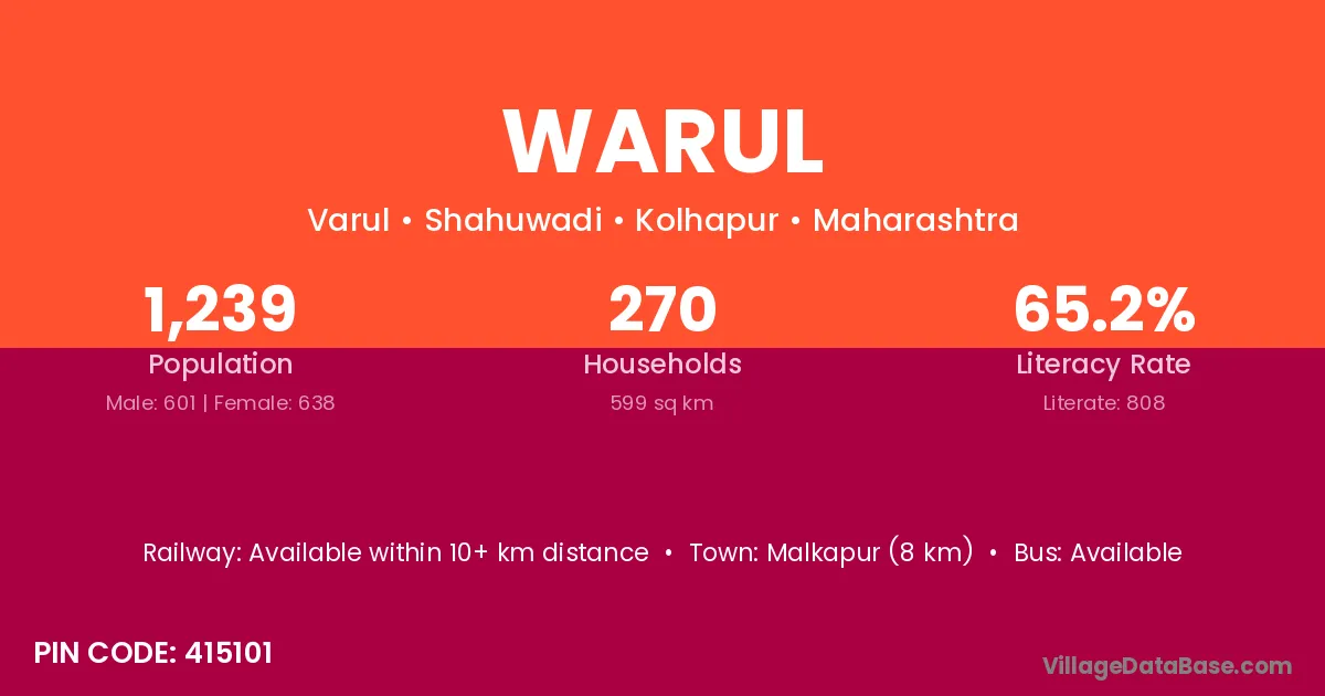
Warul village is located in the Shahuwadi Tehsil of the Kolhapur district in Maharashtra .
Block / Tehsil → Shahuwadi
District → Kolhapur
State → Maharashtra
According to Census 2011 information, the village code of Warul village is 415101.
Warul village has a total population of 1,239 people, of which 601 are males and 638 are females.
The literacy rate of Warul village is 65.21%. Male literacy stands at 71.88% and female literacy at 58.93%.
There are approximately 270 households in Warul village.
Malkapur (8 km) is the nearest town to Warul village for major economic activities and is located approximately 8 km away.
The population of Warul village is distributed between literate and illiterate residents as follows:
| Particulars | Male | Female | Total |
|---|---|---|---|
| Literate | 432 | 376 | 808 |
| Illiterate | 169 | 262 | 431 |
| Total | 601 | 638 | 1,239 |
Source: Census 2011
| Village | District |
|---|---|
| Ainwadi | Kolhapur |
| Ainwadi | Sangli |
| Chalanwadi | Kolhapur |
| Dhanagarwadi | Bid |
| Dhanagarwadi | Kolhapur |
| Gholasvade | Kolhapur |
| Humbavali | Kolhapur |
| Jawali | Janjgir Champa |
| Jawali | Korba |
| Jawali | Mandi |
| Jawali | Hoshangabad |
| Jawali | Kolhapur |
| Jawali | Raigarh |
| Jawali | Yavatmal |
| Jawali | Pali |
| Jawali | Mathura |
| Karungale | Kolhapur |
| Kasarde | Kolhapur |
| Kasarde | Sindhudurg |
| Masnoli | Kolhapur |
| Nile | Kolhapur |
| Valur | Shimoga |
| Valur | Kolhapur |
No reviews yet. Be the first to review this village!
Available within 10+ km distance
Available within village
Available within 10+ km distance