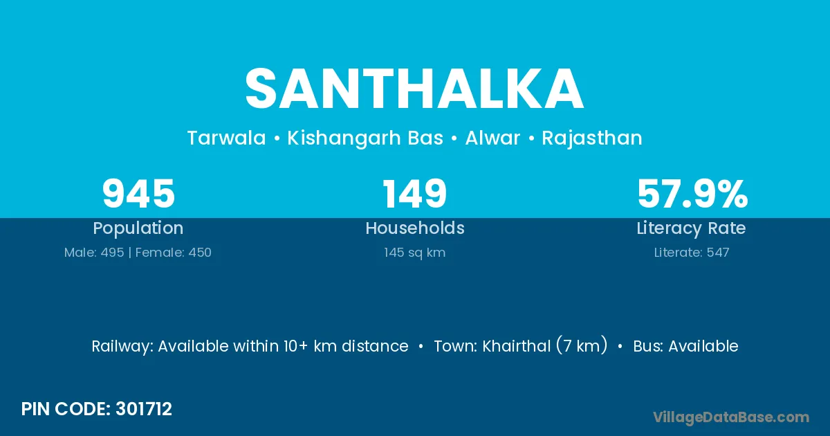
Santhalka village is located in the Kishangarh Bas Tehsil of the Alwar district in Rajasthan .
Block / Tehsil → Kishangarh Bas
District → Alwar
State → Rajasthan
According to Census 2011 information, the village code of Santhalka village is 301712.
Santhalka village has a total population of 945 people, of which 495 are males and 450 are females.
The literacy rate of Santhalka village is 57.88%. Male literacy stands at 69.49% and female literacy at 45.11%.
There are approximately 149 households in Santhalka village.
Khairthal (7 km) is the nearest town to Santhalka village for major economic activities and is located approximately 7 km away.
The population of Santhalka village is distributed between literate and illiterate residents as follows:
| Particulars | Male | Female | Total |
|---|---|---|---|
| Literate | 344 | 203 | 547 |
| Illiterate | 151 | 247 | 398 |
| Total | 495 | 450 | 945 |
Source: Census 2011
| Village | District |
|---|---|
| Basai Kalan | Alwar |
| Basai Kalan | Agra |
| Isepur | Nawada |
| Isepur | Gwalior |
| Isepur | Alwar |
| Isepur | Bara Banki |
| Isepur | Bulandshahr |
| Isepur | Farrukhabad |
| Isepur | Mahamaya Nagar |
| Lisana | Rewari |
| Lisana | Alwar |
| Mahond | Alwar |
| Mancha | Alwar |
| Mancha | Bankura |
| Meerka | Alwar |
| Nangli Mewan | Alwar |
| Nangli Pathan | Alwar |
| Sahoowas | Alwar |
| Seokhera | Alwar |
| Tohri | Alwar |
No reviews yet. Be the first to review this village!
Available within 10+ km distance
Available within 5 - 10 km distance
Available within 5 - 10 km distance