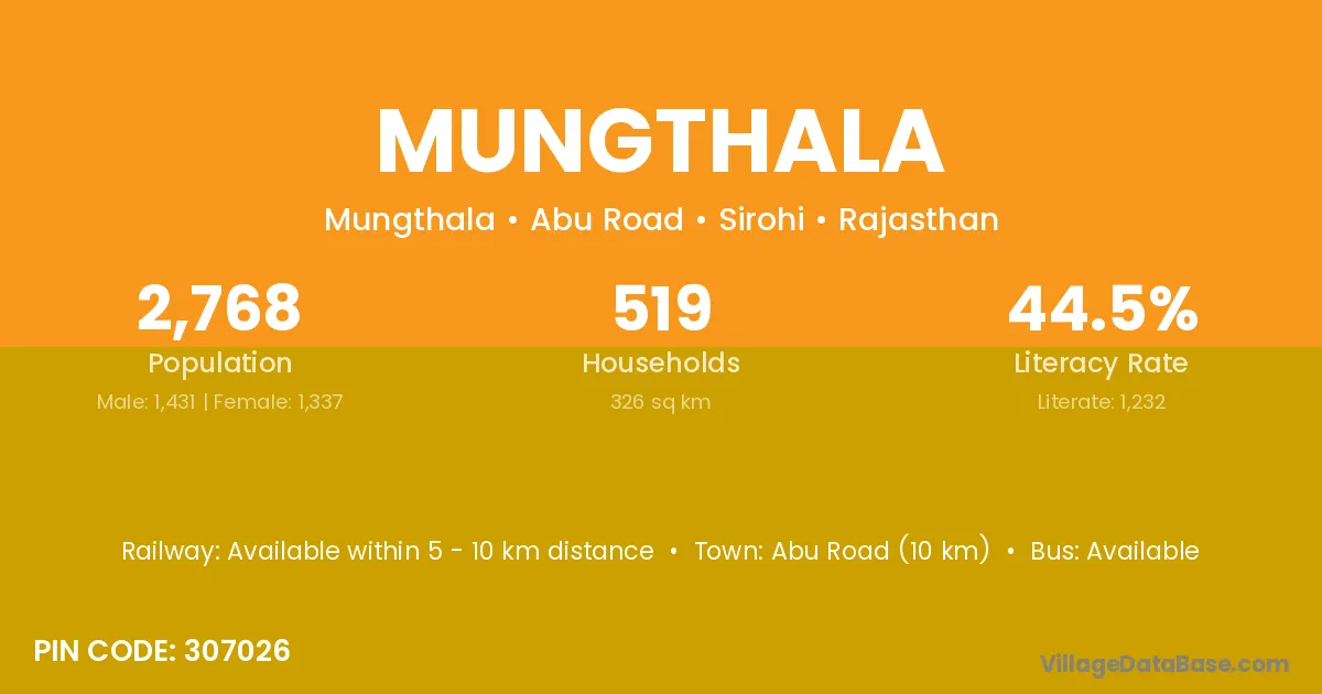
Mungthala village is located in the Abu Road Tehsil of the Sirohi district in Rajasthan .
Block / Tehsil → Abu Road
District → Sirohi
State → Rajasthan
According to Census 2011 information, the village code of Mungthala village is 307026.
Mungthala village has a total population of 2,768 people, of which 1,431 are males and 1,337 are females.
The literacy rate of Mungthala village is 44.51%. Male literacy stands at 55.14% and female literacy at 33.13%.
There are approximately 519 households in Mungthala village.
Abu Road (10 km) is the nearest town to Mungthala village for major economic activities and is located approximately 10 km away.
The population of Mungthala village is distributed between literate and illiterate residents as follows:
| Particulars | Male | Female | Total |
|---|---|---|---|
| Literate | 789 | 443 | 1,232 |
| Illiterate | 642 | 894 | 1,536 |
| Total | 1,431 | 1,337 | 2,768 |
Source: Census 2011
No reviews yet. Be the first to review this village!
Available within 5 - 10 km distance
Available within village
Available within 5 - 10 km distance