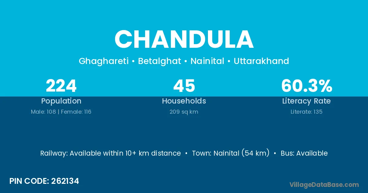
Chandula village is located in the Betalghat Tehsil of the Nainital district in Uttarakhand .
Block / Tehsil → Betalghat
District → Nainital
State → Uttarakhand
According to Census 2011 information, the village code of Chandula village is 262134.
Chandula village has a total population of 224 people, of which 108 are males and 116 are females.
The literacy rate of Chandula village is 60.27%. Male literacy stands at 73.15% and female literacy at 48.28%.
There are approximately 45 households in Chandula village.
Nainital (54 km) is the nearest town to Chandula village for major economic activities and is located approximately 54 km away.
The population of Chandula village is distributed between literate and illiterate residents as follows:
| Particulars | Male | Female | Total |
|---|---|---|---|
| Literate | 79 | 56 | 135 |
| Illiterate | 29 | 60 | 89 |
| Total | 108 | 116 | 224 |
Source: Census 2011
| Village | District |
|---|---|
| Dabarbadi | Nainital |
| Ghaghreti | Nainital |
| Haldyani | Nainital |
| Halla Lagga Baroseer | Nainital |
| Halsau | Nainital |
| Joshi Khola | Nainital |
| Korar | Gopalganj |
| Korar | Saran |
| Korar | Siwan |
| Korar | Uttar Bastar Kanker |
| Korar | Gorakhpur |
| Korar | Nainital |
| Korar | Barddhaman |
| Malla Bardho | Nainital |
| Raheli | Gonda |
| Raheli | Moradabad |
| Raheli | Nainital |
| Sonli | Nainital |
| Talla Bardho | Nainital |
No reviews yet. Be the first to review this village!
Available within 10+ km distance
Available within 10+ km distance
Available within 10+ km distance