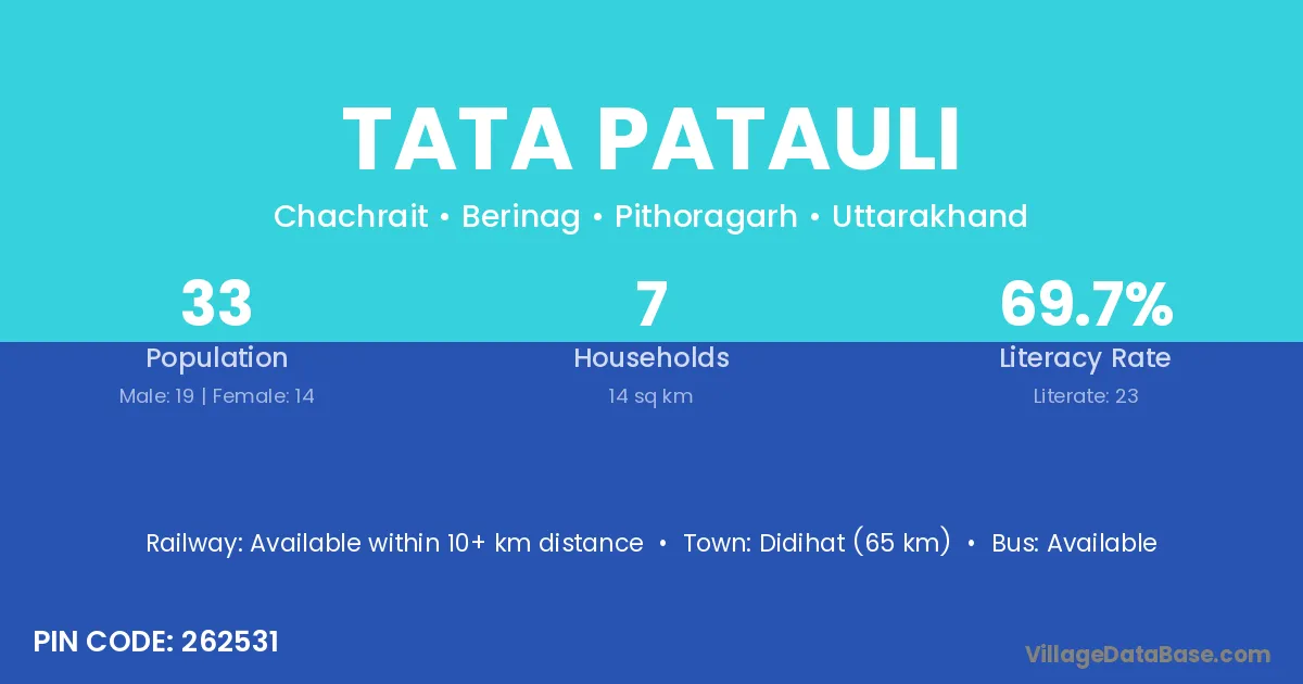
Tata Patauli village is located in the Berinag Tehsil of the Pithoragarh district in Uttarakhand .
Block / Tehsil → Berinag
District → Pithoragarh
State → Uttarakhand
According to Census 2011 information, the village code of Tata Patauli village is 262531.
Tata Patauli village has a total population of 33 people, of which 19 are males and 14 are females.
The literacy rate of Tata Patauli village is 69.70%. Male literacy stands at 68.42% and female literacy at 71.43%.
There are approximately 7 households in Tata Patauli village.
Didihat (65 km) is the nearest town to Tata Patauli village for major economic activities and is located approximately 65 km away.
The population of Tata Patauli village is distributed between literate and illiterate residents as follows:
| Particulars | Male | Female | Total |
|---|---|---|---|
| Literate | 13 | 10 | 23 |
| Illiterate | 6 | 4 | 10 |
| Total | 19 | 14 | 33 |
Source: Census 2011
| Village | District |
|---|---|
| Bana | Gaya |
| Bana | Janjgir Champa |
| Bana | Kachchh |
| Bana | Reasi |
| Bana | Garhwa |
| Bana | Garhwa |
| Bana | Latehar |
| Bana | Palamu |
| Bana | Saraikela Kharsawan |
| Bana | Saraikela Kharsawan |
| Bana | Baleshwar |
| Bana | Shahid Bhagat Singh Nagar |
| Bana | Bikaner |
| Bana | Mathura |
| Bana | Meerut |
| Bana | Nainital |
| Bana | Pithoragarh |
| Bhuni Gaon | Pithoragarh |
| Bora Khet | Pithoragarh |
| Chankana | Pithoragarh |
| Gwir Panth | Pithoragarh |
| Kwerali | Pithoragarh |
| Ligurani | Pithoragarh |
| Patharari | Pithoragarh |
| Reetha | Sant Kabir Nagar |
| Reetha | Champawat |
| Reetha | Champawat |
| Reetha | Pithoragarh |
| Seli | Solan |
| Seli | Barwani |
| Seli | Pithoragarh |
| Tamoli Gwir | Pithoragarh |
No reviews yet. Be the first to review this village!
Available within 10+ km distance
Available within <5 km distance
Available within <5 km distance