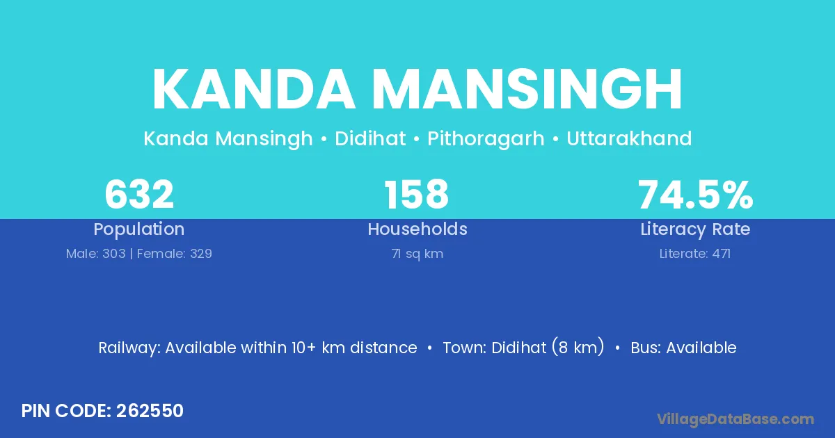
Kanda Mansingh village is located in the Didihat Tehsil of the Pithoragarh district in Uttarakhand .
Block / Tehsil → Didihat
District → Pithoragarh
State → Uttarakhand
According to Census 2011 information, the village code of Kanda Mansingh village is 262550.
Kanda Mansingh village has a total population of 632 people, of which 303 are males and 329 are females.
The literacy rate of Kanda Mansingh village is 74.53%. Male literacy stands at 79.87% and female literacy at 69.60%.
There are approximately 158 households in Kanda Mansingh village.
Didihat (8 km) is the nearest town to Kanda Mansingh village for major economic activities and is located approximately 8 km away.
The population of Kanda Mansingh village is distributed between literate and illiterate residents as follows:
| Particulars | Male | Female | Total |
|---|---|---|---|
| Literate | 242 | 229 | 471 |
| Illiterate | 61 | 100 | 161 |
| Total | 303 | 329 | 632 |
Source: Census 2011
| Village | District |
|---|---|
| Baltir | Pithoragarh |
| Bhul Gaon | Bageshwar |
| Bhul Gaon | Pithoragarh |
| Bhumiyathal | Pithoragarh |
| Kanda Jhusiya | Pithoragarh |
| Karauli | Dungarpur |
| Karauli | Auraiya |
| Karauli | Bijnor |
| Karauli | Sonbhadra |
| Karauli | Unnao |
| Karauli | Champawat |
| Karauli | Pithoragarh |
| Kasindev | Pithoragarh |
| Ladhara | Pithoragarh |
| Malli Mirthi | Pithoragarh |
| Ogala | Barmer |
| Ogala | Pithoragarh |
| Sata | Rayagada |
| Sata | Barmer |
| Sata | Jaisalmer |
| Sata | Sultanpur |
| Sata | Pithoragarh |
| Talli Mirthi | Pithoragarh |
No reviews yet. Be the first to review this village!
Available within 10+ km distance
Available within village
Available within village