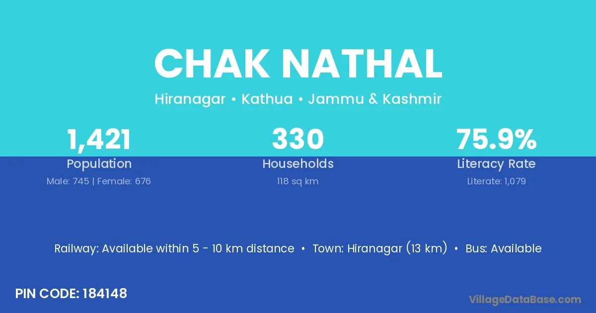
Chak Nathal village is located in the Hiranagar Tehsil of the Kathua district in Jammu & Kashmir .
Block / Tehsil → Hiranagar
District → Kathua
State → Jammu & Kashmir
According to Census 2011 information, the village code of Chak Nathal village is 184148.
Chak Nathal village has a total population of 1,421 people, of which 745 are males and 676 are females.
The literacy rate of Chak Nathal village is 75.93%. Male literacy stands at 81.07% and female literacy at 70.27%.
There are approximately 330 households in Chak Nathal village.
Hiranagar (13 km) is the nearest town to Chak Nathal village for major economic activities and is located approximately 13 km away.
The population of Chak Nathal village is distributed between literate and illiterate residents as follows:
| Particulars | Male | Female | Total |
|---|---|---|---|
| Literate | 604 | 475 | 1,079 |
| Illiterate | 141 | 201 | 342 |
| Total | 745 | 676 | 1,421 |
Source: Census 2011
| Village | District |
|---|---|
| Chak Shiba | Kathua |
| Chapaki Kalan | Kathua |
| Chapaki Khurd | Kathua |
| Haripur Barhmanan | Kathua |
| Hor | Kathua |
| Ladhwal Kalan | Kathua |
| Ladhwal Khurd | Kathua |
| Malwan | Aurangabad |
| Malwan | Kathua |
| Malwan | Kulgam |
| Malwan | Barwani |
| Malwan | Jhabua |
| Malwan | Banswara |
| Malwan | Udaipur |
| Malwan | Fatehpur |
| Parkh Wal | Kathua |
| Partyal | Kathua |
| Wand Manhas | Kathua |
No reviews yet. Be the first to review this village!
Available within 5 - 10 km distance
Available within village
Available within village