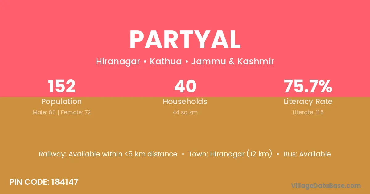
Partyal village is located in the Hiranagar Tehsil of the Kathua district in Jammu & Kashmir .
Block / Tehsil → Hiranagar
District → Kathua
State → Jammu & Kashmir
According to Census 2011 information, the village code of Partyal village is 184147.
Partyal village has a total population of 152 people, of which 80 are males and 72 are females.
The literacy rate of Partyal village is 75.66%. Male literacy stands at 75.00% and female literacy at 76.39%.
There are approximately 40 households in Partyal village.
Hiranagar (12 km) is the nearest town to Partyal village for major economic activities and is located approximately 12 km away.
The population of Partyal village is distributed between literate and illiterate residents as follows:
| Particulars | Male | Female | Total |
|---|---|---|---|
| Literate | 60 | 55 | 115 |
| Illiterate | 20 | 17 | 37 |
| Total | 80 | 72 | 152 |
Source: Census 2011
| Village | District |
|---|---|
| Balahn Pain | Kathua |
| Bandhor | Kathua |
| Chak Nathal | Kathua |
| Chak Shiba | Kathua |
| Karandi Khurd | Kathua |
| Khan Pur | Kathua |
| Khan Pur | Samba |
| Khan Pur | Bara Banki |
| Khan Pur | Bara Banki |
| Khan Pur | Farrukhabad |
| Khan Pur | Kannauj |
| Ladhwal Khurd | Kathua |
| Malwan | Aurangabad |
| Malwan | Kathua |
| Malwan | Kulgam |
| Malwan | Barwani |
| Malwan | Jhabua |
| Malwan | Banswara |
| Malwan | Udaipur |
| Malwan | Fatehpur |
| Parkh Wal | Kathua |
| Parso Chak | Kathua |
| Wand Manhas | Kathua |
No reviews yet. Be the first to review this village!
Available within <5 km distance
Available within <5 km distance
Available within <5 km distance