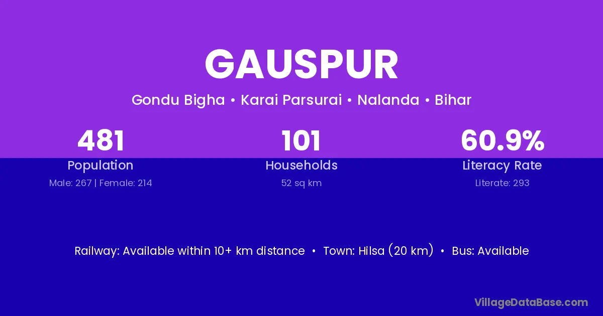
Gauspur village is located in the Karai Parsurai Subdivision of the Nalanda district in Bihar .
Block / Subdivision → Karai Parsurai
District → Nalanda
State → Bihar
Gauspur village has a total population of 481 people, of which 267 are males and 214 are females.
The literacy rate of Gauspur village is 60.91%. Male literacy stands at 72.28% and female literacy at 46.73%.
There are approximately 101 households in Gauspur village.
Hilsa (20 km) is the nearest town to Gauspur village for major economic activities and is located approximately 20 km away.
The population of Gauspur village is distributed between literate and illiterate residents as follows:
| Particulars | Male | Female | Total |
|---|---|---|---|
| Literate | 193 | 100 | 293 |
| Illiterate | 74 | 114 | 188 |
| Total | 267 | 214 | 481 |
Source: Census 2011
No reviews yet. Be the first to review this village!
Available within 10+ km distance
Available within 5 - 10 km distance
Available within <5 km distance