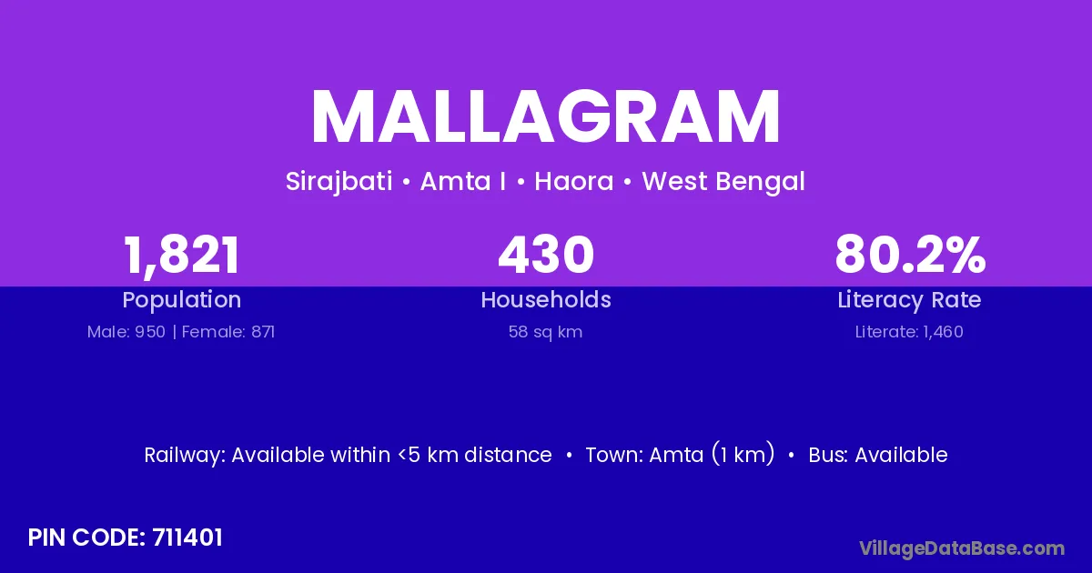
Mallagram village is located in the Amta I Subdivision of the Haora district in West Bengal .
Block / Subdivision → Amta I
District → Haora
State → West Bengal
According to Census 2011 information, the village code of Mallagram village is 711401.
Mallagram village has a total population of 1,821 people, of which 950 are males and 871 are females.
The literacy rate of Mallagram village is 80.18%. Male literacy stands at 83.79% and female literacy at 76.23%.
There are approximately 430 households in Mallagram village.
Amta (1 km) is the nearest town to Mallagram village for major economic activities and is located approximately 1 km away.
The population of Mallagram village is distributed between literate and illiterate residents as follows:
| Particulars | Male | Female | Total |
|---|---|---|---|
| Literate | 796 | 664 | 1,460 |
| Illiterate | 154 | 207 | 361 |
| Total | 950 | 871 | 1,821 |
Source: Census 2011
| Village | District |
|---|---|
| Bara Mahara | Haora |
| Chakpota | Haora |
| Chhota Mahara | Haora |
| Kalikata | Haora |
| Khasnan | Haora |
| Kotalpara | Pakur |
| Kotalpara | Haora |
| Kotalpara | Hugli |
| Kotalpara | Hugli |
| Madaria | Darbhanga |
| Madaria | Saran |
| Madaria | Gorakhpur |
| Madaria | Haora |
| Purba Gazipur | Haora |
| Ranapara | Dausa |
| Ranapara | Haora |
| Sameshwar | Haora |
| Serajbati | Haora |
No reviews yet. Be the first to review this village!
Available within <5 km distance
Available within <5 km distance
Available within village