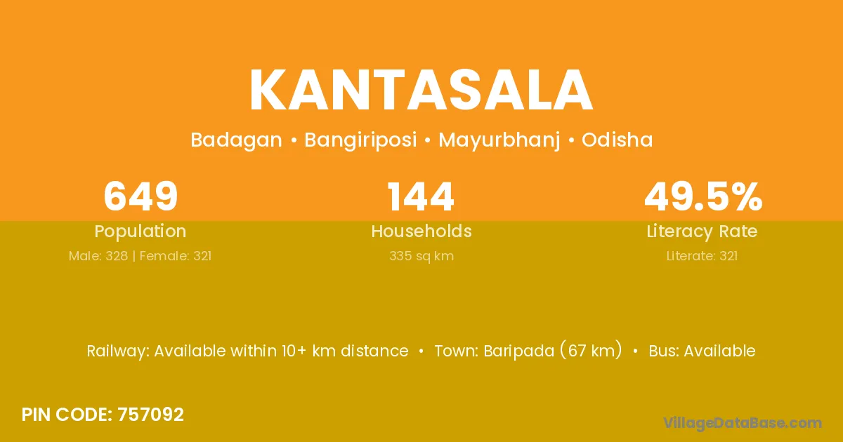
Kantasala village is located in the Bangiriposi Tehsil of the Mayurbhanj district in Odisha .
Block / Tehsil → Bangiriposi
District → Mayurbhanj
State → Odisha
According to Census 2011 information, the village code of Kantasala village is 757092.
Kantasala village has a total population of 649 people, of which 328 are males and 321 are females.
The literacy rate of Kantasala village is 49.46%. Male literacy stands at 62.50% and female literacy at 36.14%.
There are approximately 144 households in Kantasala village.
Baripada (67 km) is the nearest town to Kantasala village for major economic activities and is located approximately 67 km away.
The population of Kantasala village is distributed between literate and illiterate residents as follows:
| Particulars | Male | Female | Total |
|---|---|---|---|
| Literate | 205 | 116 | 321 |
| Illiterate | 123 | 205 | 328 |
| Total | 328 | 321 | 649 |
Source: Census 2011
No reviews yet. Be the first to review this village!
Available within 10+ km distance
Available within 10+ km distance
Available within village